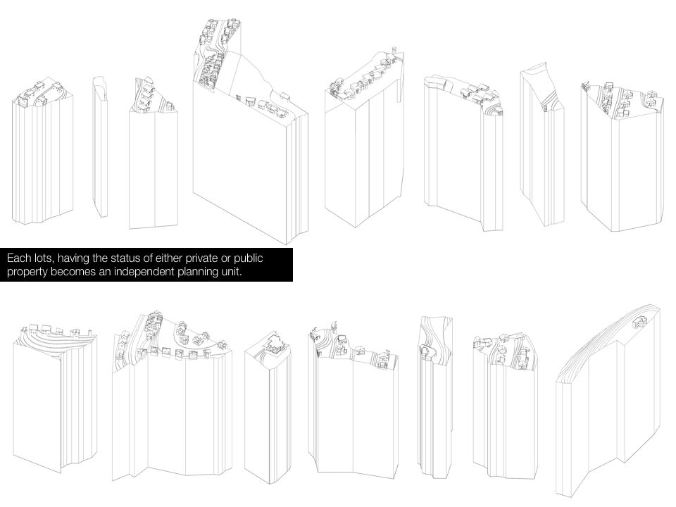
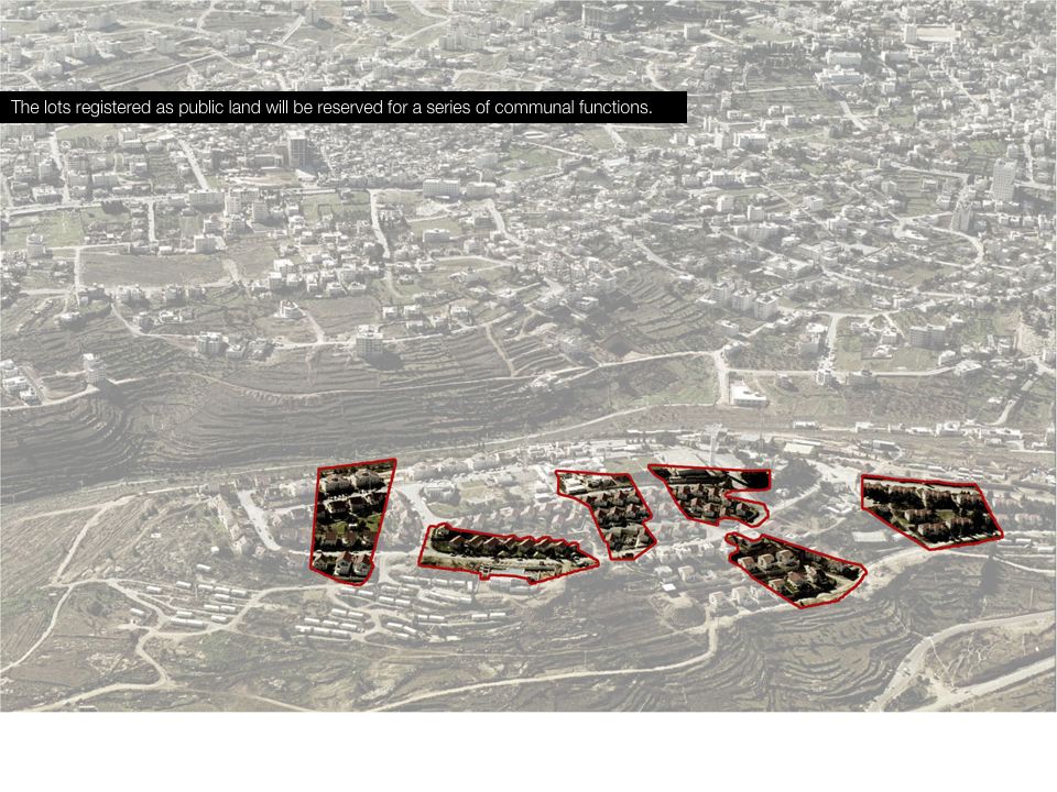
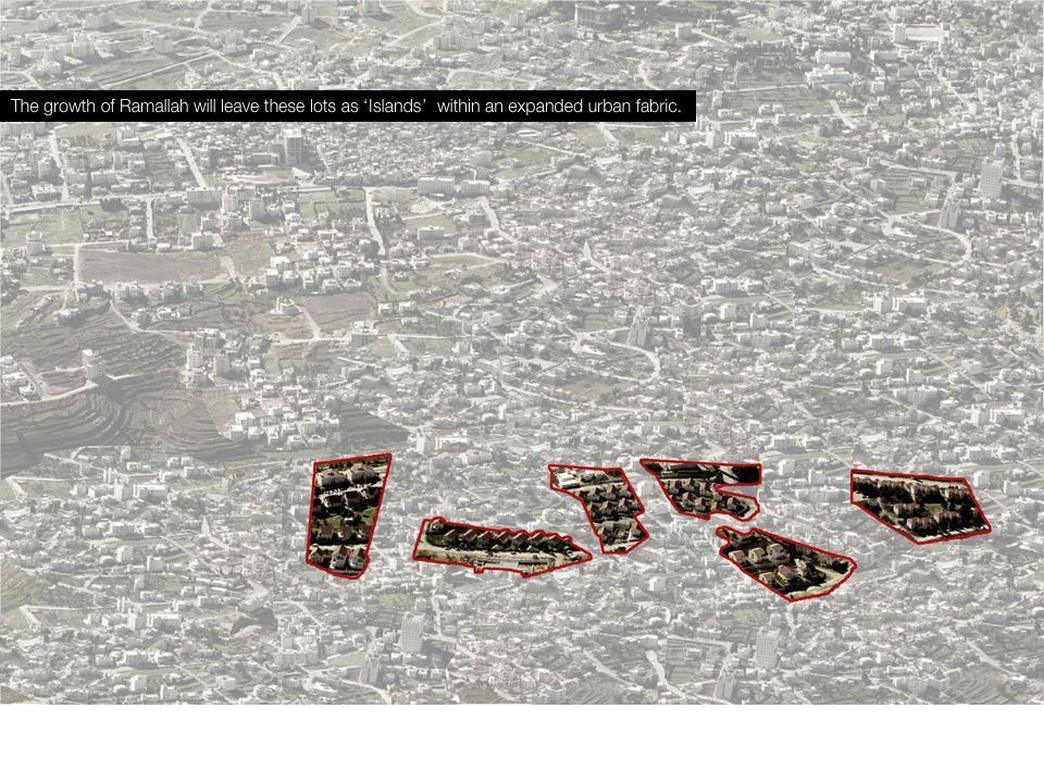
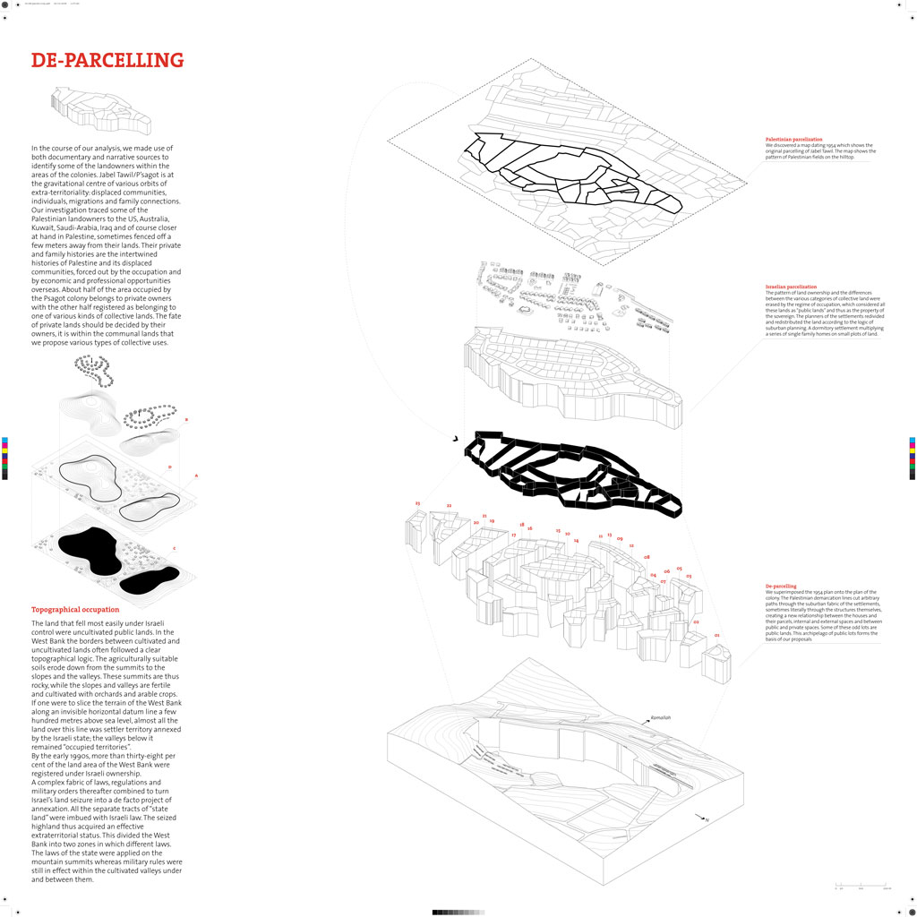
In the course of our analysis, we made use of both documentary and narrative sources to identify some of the landowners within the areas of the colonies. Jabel Tawil/P’sagot is at the gravitational centre of various orbits of extra-territoriality: displaced communities, individuals, migrations and family connections. Our investigation traced some of the Palestinian landowners to the US, Australia, Kuwait, Saudi-Arabia, Iraq and of course closer at hand in Palestine, sometimes fenced off a few meters away from their lands. Their private and family histories are the intertwined histories of Palestine and its displaced communities, forced out by the occupation and by economic and professional opportunities overseas. About half of the area occupied by the Psagot colony belongs to private owners with the other half registered as belonging to one of various kinds of collective lands. The fate of private lands should be decided by their owners. It is within the communal lands that we propose various types of collective uses.
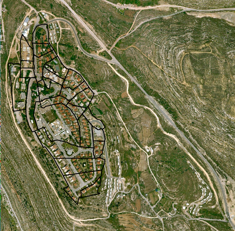
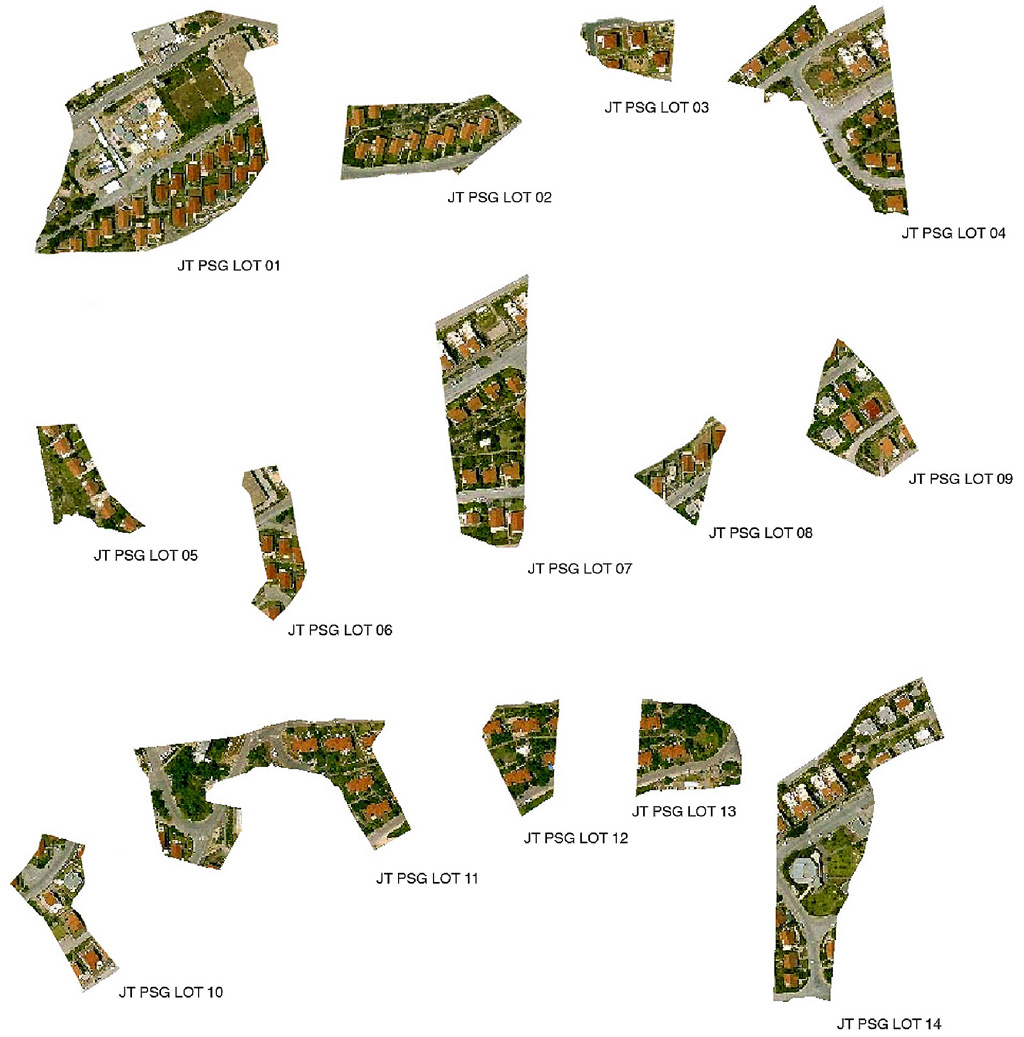
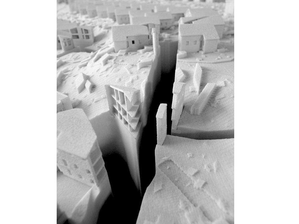
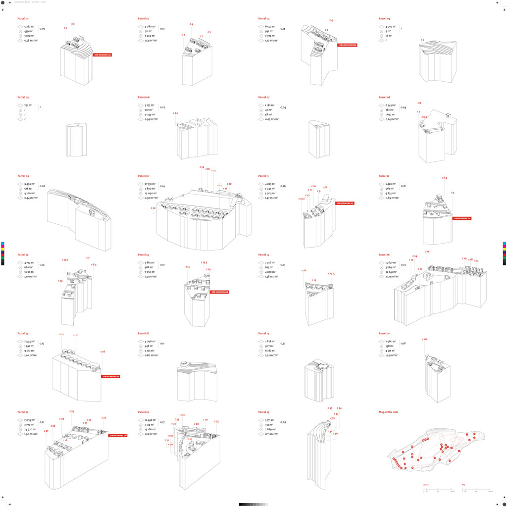
We discovered a map dating from 1954 which shows the original parcelization of Jabel Tawil. We superimposed the 1954 plan onto the plan of the colony. The Palestinian demarcation lines cut arbitrary paths through the suburban fabric of the settlements, sometimes literally through the structures themselves, creating a new relationship between the houses and their parcels, internal and external spaces and between public and private spaces. Some of these odd lots are public lands. This archipelago of public lots forms the basis of our proposals.
DECOLONIZATION MANUAL Conception and design overview by Salottobuono
Eyal Weizman and Alessandro Petti explaining the concept of deparcelization:
http://youtu.be/hZxvNGJwvt8
Interview with the former mayor of Al Bireh
Parcelization of the land:
http://youtu.be/7Exn7lr165A
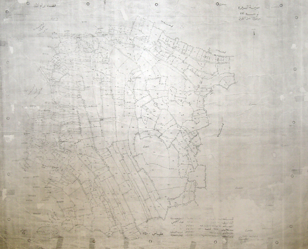 A map from 1954 showing the parcelization of the land where the colony P’sagot was built