In 1993 a series of secret talks held in Oslo between Israeli and Palestinian representatives inaugurated what was later referred to as the “Oslo Process”. As is well known, this process defined three types of territories within the West Bank: Area A under Palestinian control, area B under Israel military control and Palestinian civilian control, and area C under full Israeli control. When the process collapsed and the temporary organization of the occupied territories solidified into a permanent splintered geography of multiple prohibitions, a fourth place was suddenly discovered. Existing between all others – it was the width of the lines separating them.
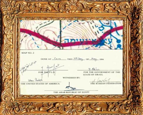
Less than a millimeter thick when drawn on the scale of 1:20,000, it measured more than 5 meters in real space.
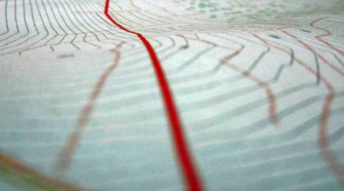
Our project dives into the thickness of this line then follows it along the edges of villages and towns, across fields, olive and fruit orchards, roads, gardens, kindergartens, fences, terraces, homes, public buildings, a football stadium, a mosque and finally a large castle recently built.